GIS study on suitable AWE sites in Germany
Identifying deployment opportunities for Airborne Wind Energy in Germany
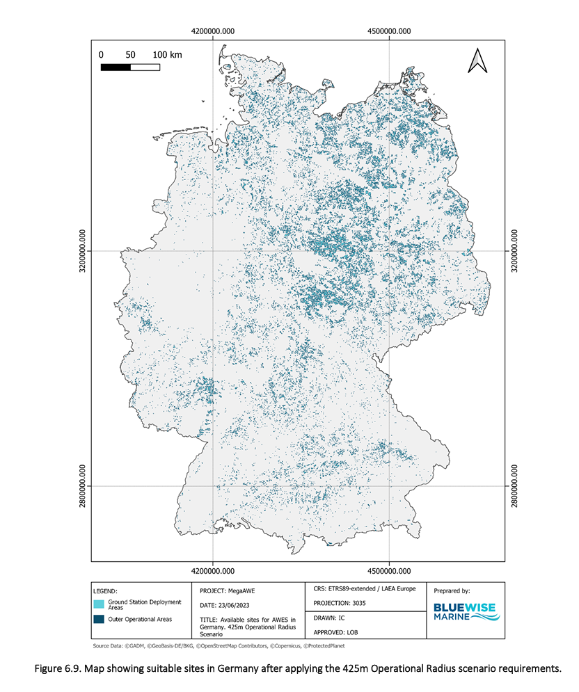
The DEM-AWE project team is assessing the deployment potential of airborne wind energy on a country-level, using an analytical tool for site identification.
Determining the potential of suitable sites and the corresponding energy output of Airborne Wind Energy (AWE) systems is essential for understanding the feasibility of their deployment and the viability of the technology. These renewable energy systems are essentially tethered aircrafts or kites, and so have unique challenges in terms of operational safety, making tailored site identification studies important for both demonstration and commercial use.
The estimation of the potential capacity of AWE systems in a particular region will make it possible to provide data about market depth and better understand the locations that can host this innovative technology. This information is important for governments, regulatory bodies, project and technology developers and energy stakeholders in setting renewable energy goals and creating policies to promote AWE adoption. Identifying high-capacity areas will help project developers to concentrate on locations that are best suited for deployment of AWE technology.
During the MegaAWE project, BlueWise Marine developed an analytical tool for this spatial analysis, which has already been applied in Germany.
👉 Zenodo repository: Site Identification Analysis for AWE Devices. A case study in Germany
The results revealed a potential capacity of 12-108 GW, depending on the tether length of each device and the size of risk buffers, like distance to settlements and publicly used infrastructure. This information has been key for providing the basis for including Airborne Wind Energy technology in Germany’s Renewable Energies Act in 2024.
Building on and refining the methodology used for the German study, BlueWise Marine, in collaboration with Laminak Energy, will identify sites suitable for deployment of AWE systems in Ireland, France, Spain and the Netherlands. The process involves integrating and evaluating various geographic characteristics (such as region-specific distribution of settlements, use of roads, etc.) while considering technological, socioeconomic, environmental, and regulatory constraints.
These areas will be identified considering:
sufficient space for deploying the Ground Stations (GS) and operating the AWE devices without flying over buildings, roads, railways or other infrastructure,
minimal risks of collisions with obstacles or other aircraft.
safe distance from public spaces, airports and protected areas,
suitable terrain for site development.
By identifying these safe operational areas, the implementation of K-BESS technology can be carried out with confidence, minimising potential hazards and maximising benefits to local communities. It should be noted that in future, once more experience with the operation of AWE system has been gained, the number of potential sites will increase as flying over certain infrastructure will then be possible.
The findings of the site identification study will be made public and detail the methodology used, identifying the specific zones suitable for AWE deployment, and evaluating the airborne wind energy potential in Ireland, France, Spain and the Netherlands. The results will be disseminated through the websites of the DEM-AWE project and its partners, relevant industry media platforms, and by means of project social media resources.